Friday, November 25, 2022

Activation Report: W7O/CE-068 Pine Benchmark - Thanksgiving Day 2022


After a successful RF high experience on Lava Butte the day prior, the weather looked stable and warm so KK7HJL and I decided to bag another of our local summits. Pine Mountain is about 25 miles SE of Bend on US Highway 20, then another 5-6 miles on a good gravel road, though in the winter it is unmaintained so travel at your own risk. November saw some snow and considerable low temps so the road was packed snow and ice once we got into the shadier valley. We weren't sure if we were going to make it but Sherman the Ram 1500 has 4 wheel drive and the warm temps made the pack snow soft enough to get traction.

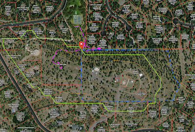
The hike starts at around 3 miles from the forest boundary, and follows an old double track almost the whole way to the top. The double track ends at on of the local paragliding launches that Pine Mountain is famous for, but a very well established trail takes you the remaining .25 miles to the summit. 

We parked at a gate at the beginning of the double track that fortunately someone had driven since the last snowfall, so there was an easy track to follow. Most of the route was snow covered but it was warm and soft enough that I walked in my Danner 2650 trail shoes without issue. We had our SOTA pack along to wear them out so that we could enjoy our Thanksgiving dinner without interruption for a poop walk. 


The hike was uneventful, though we noticed some signs of deer and cougar along the way. We made quick work of the walk and upon arriving at the summit, noticed the windsock standing out straight as an arrow. The wind took off both our hats and we made a run for the summit photo before descending back to the edge of the activation zone where there was a little shelter of rocks to block the wind. 


With the wind howling and our dogs getting anxious we decided to make quick work of the 2M activation. 

KC7UJO on 2M

  • N7KOM
  • KD6PLU
  • N5LR
  • K7CWQ
And that's a wrap, all in about 5 minutes.

The hike down went quickly and without drama and we were back home in time for lunch and a nap before heading to our Thanksgiving dinner party.

View from Summit


Pine Benchmark is a pretty easy and straight forward activation. Park at the gate or just inside if the road is clear and follow the double track to the top. Be aware that the road is unmaintained in the winter and you may need 4 wheel drive or a snow machine/skis/snowshoes if you want to get those bonus points. And check the winds aloft! I had planned to setup and operate HF but due to the high winds chose to ditch that idea. Operators will often combine Pine Benchmark and Pine Mountain, W7O/CE-058 into a single day. We thought about it but after getting a good look at the ascent and the condition of the access road combined with the high summit winds the day we were there, we decided it would be ok to come back another time.


Activation Report: W7O/CE-188 - Lava Butte

 We haven't been terribly active on the air of late. Only one activation since August, so we (KK7HJL and I) decided to take a couple hours on Thanksgiving Eve to hike up Lava Butte to activate. While the park is "closed" they do leave the gate to the parking lot open to allow folks to walk up the road to the top for some epic view of the Central Oregon mountains. 

November has been pretty cold, and we had a couple of good snowstorms early in the month, leaving the road a mix of compacted snow and ice in areas that don't see much sun. On this particular day, the outside air temp was hovering around 50 degrees so the top layer of the white snow was fairly easy to walk on, and any areas of the road exposed to the sun were dry or nearly so. The walk from the parking lot took about 60 minutes and we had the place to ourselves when we reached the top, though we didn't expect to see many people, there was only 1 car in the lot when we arrived. 

Since I had already activated Lava Butte back in April, I was mostly along for morale support for Randi and to test my rusty CW skills. I recently received the Penntek 35 radio I built back from the kit manufacturer after experiencing an audio chip failure. John WA3RNC, very graciously asked me to send the radio to him to troubleshot and fix it at no cost. I had taken it out a couple of other times but didn't make any contacts so I was anxious to see if I could do better from a summit. 


I had intended to try 40,20 and 17 meters so I started on by setting up my K6ARK End Fed Half Wave on 40. I called QRL and heard a very faint, slightly off-frequency response, but was unable to make it out on the summit. Later, K7ATN emailed to let me know that he had heard my QRL and responded with 'SOTA?'. I had to listen to the recording several times, but I was able to make that out eventually. Regardless, I began calling CQ and worked 7 or 8 stations. I struggled with WB6POT but he patiently kept with me, turns out B and 6 are difficult for me to distinguish. 


Meanwhile, Randi - KK7HJL, began calling CQ on 2M. She did the entire activation on her own, didn't ask for any prompts and made 6 contacts around Central Oregon. She said she was in search of that RF High she learned about after our recent activation on Catalina Island in late October.

Since my copy skills weren't great I decided to shut it down and tear down instead of trying 20 or 17M. Again, this was about getting her out more than my needing to collect contacts. Also, the tourists had started to arrive and we didn't want to be annoying anyone. We managed to tear down and bug out after only a 30 minute activation, which left us plenty of time to grab a beer at the Boneyard Pub back in Bend on our way back to the QTH. We lucked out and found an unoccupied couch to sit and enjoy our delicious malt beverages while watching a replay of the USA vs Canada women's hockey match from the previous weekend. 


Lava Butte National Volcanic Monument is a pretty easy SOTA/POTA site. During the "season" there is a charge to park in the lot but once they close the monument for the winter, it's free parking. Access is easy from US 97 Southbound about 4 miles south of Bend. The Northbound 97 exit is closed in the winter. The hike up is about 1.5 miles of pavement and there are plenty of places to setup to activate once on top. Eventually there will be a paved path from the south end of Bend up to Lava Butte, making it a very easy bicycle ride or walk from town but until then you either have to drive or take the Deschutes River Trail like Tim - N7KOM and I did back in April. This would be a great first SOTA activation destination as the views are top notch and one can easily get 2M contacts from Bend and LaPine. 

PNW Campout Report

On the weekend of July 8-11, SOTA activators from California, Oregon and Washington gathered at Hyatt Lake campground in the Cascade-Siskiyou National Monument near Ashland, OR. Amy Hamptonstall (AG7GP) and her partner Robin (N7HAP) organized the gathering as a way for SOTA operators to get together and activate lots of summits with plenty of Summit to Summit opportunities. A total of 26 summits were activated over three days with 2 brand new operators getting their first QSO's and first summits. 

One of the new operators, KK7HJL, is my YL, Randi. She decided to study for her tech license after going with me on several outings in Central Oregon as we pursue the Big Butte Challenge 2022, which has 4 SOTA summits. While its not a radio event per se, we have used it as a motivator to get out and activate some areas we would otherwise never visit.

Rye Spur
On our drive down to the campout we spent a night at Lake of the Woods  Aspen Point campground, which was conveniently on our route and situated a short distance to Rye Spur (W7O/CS-053). After a wonderful nights rest, we got up early to drive over to attempt the summit. The drive in took a bit due to all the brush and we took an early wrong turn. We ultimately found the parking area at the end of the road, what looks like a hunters camp, and leashed up the doggos to attempt the short 0.3 mile walk to the summit. There is not a trail to the top so its a bush wack. We tried heading straight up, but quickly hit walls of young evergreens and lots of ceanothus. We backtracked the few hundred yards and found a trail that led out the back of the camp area, that looked to head towards the Rye Spur trail that goes to the east of the summit, but unfortunately, the approach is much steeper from that side. It was difficult to move through the growth with the dogs on leashes and we didn't trust them off leash in an area we aren't familiar with so we had to throw in the towel in order to make it back to camp and depart by checkout time.


Upon arrival at the campout location we took our time setting up, it was quite a bit warmer than the previous day so we sat out a the picnic table in our site and had a cocktail. I setup the Buddipole and did some chasing but didn't catch anything. We were camped next to K7MAS and his XYL. They courteously let us park the truck in part of their parking area since it wouldn't fit int our site with the trailer. I had booked the site thinking I would be solo in our van, which would have fit swimmingly, but the trailer took up the whole area. K7MAS headed out to activate Table Mtn, a short drive from camp. We told him that Randi had just received her callsign assignment earlier that morning. I turned on the handheld and when he called CQ I answered and handed the HT to Randi. I coached her through the QSO and she did great.
 
That evening K7ATN made the rounds to check us in and let us know the loose plan for the weekend. Most of the clan were gathered in the A Loop sites, we were in B Loop. Amy had a whiteboard up for folks to use as a quick reference to see who was planning what the next couple of days. Since we had our dogs, we didn't want to attempt anything that was going to require bush-wacking and Amy suggested we try Grizzly Peak, a popular day hike for folks from Ashland/Medford.


Lookout from the West side of Grizzly Peak
We slept really well and had a leisurely morning in camp. The drive to the parking area took about 45 mins. We got there just in time as 7 or 8 other vehicles rolled in behind us. We managed to find a spot in the shade to park the truck but it was pretty much the last spot in the lot, so folks just started parking on the road, this is definitely a popular trail and would probably be a better to get an earlier start that we had. Yamato, our 13 year old dachshund, was insistent about coming along for the day. Since we didn't want to leave him alone in the truck, Randi unloaded her backpack and loaded him into it. While it wasn't perfect, it worked really well for the 2 mile hike to the activation area. The trail is very well groomed but its no joke, it goes up quickly. We met lots of folks coming down but once we got near the top it thinned out. We found a nice spot in the shade in the AZ. We pulled out the handheld and heard W6DER calling CQ and I jumped right in. We traded off working one caller after another, it was very hectic on 146.58 with 25 activators all trying to talk to one another along with the chasers. We spent about 45 mins making contacts before the shade dissolved and the pups were getting restless so we packed up the kit and headed back down to the trail. On the return trip , we headed out towards the western side of the loop to get a great view of Ashland from above.


That evening we gathered around the campfire and organized the next days summits. We decided to try Soda Mtn on recommendation from K7MAS. Mark suggested approaching via the Pacific Crest Trail instead of walking up the road, which was a much nicer hike and less sun exposed for the doggos. The hike up went smoothly, we took a break to chat up a couple of LASH (long ass section hikers) on the PCT. The last 1/2 mile gets pretty steep on the 2 track but it was fine and the 360 degrees views from the top made it all worth while.  

Activation Report: W7O/CE-213 - Awbrey Butte,OR | February 2023

Awbrey Butte Summit Green: AX, Magenta: Trail, Blue: Fence line After a little encouragement from Tim, N7KOM, I decide to try Awbrey Butte, ...